

The Moore tornado left extreme damage indicators throughout its path consistent with EF5 intensity.
□ On May 20, 2013, a large funnel touched down in Grady County, Oklahoma. Similar in many ways to the devastating Bridge Creek tornado of 1999, the storm travelled at a fairly slow pace and was tracked by weather helicopters as it roared towards the southern suburbs of Oklahoma City. The tornado rapidly strengthened as it crossed Drexel Avenue and likely reached EF5 intensity three miles west of Moore. A pronounced streak of ground scouring marked the tornado’s inner core as it travelled almost due east through a low density residential area with dozens of large, well-constructed homes. A three-story mansion on South Mays Avenue was nearly leveled by the tornado despite being spared the storm’s most intense winds. Residences impacted directly by the tornado were swept completely away and adjacent trees were stripped of all bark and branches. Vehicles from destroyed homes were thrown over a quarter mile and mangled beyond recognition. After crossing Western Avenue, the core of the storm travelled parallel to a residential subdivision before slamming into Briarwood Elementary School at EF5 intensity. After destroying the school, the tornado entered a densely populated section of Moore at high-end EF4 intensity. Every home within a 150 yard wide swath was completely leveled as the storm made a turn to the northeast. Damage patterns indicate that the tornado briefly reached EF5 strength a second time as it crossed over Plaza Towers Elementary and adjacent homes. More than half of the fatalities occurred in this area.
The tornado continued curving to the northeast before reaching Telephone Road, at which point the storm made a turn to the east-southeast. The northernmost building affected by EF4 winds was a 7-Eleven convenient store where four people sheltering in a walk-in freezer were killed. After crossing the I-35, the tornado abruptly narrowed but continued leaving a streak of EF4 damage. The tornado’s final fatality occurred just west of Highland East Junior High School. In total, the tornado destroyed more than 1,500 homes and caused nearly 2 billion dollars in damage. I surveyed the damage in Moore in the last week of May. My final analysis can be found at bottom.

A tree line just west of Pennsylvania Avenue was stripped bare. The tornado likely reached EF5 intensity less than a minute before striking this area. Five of the storm’s fatalities occurred in large homes swept completely away between Drexel Avenue and SW 155th Street.

A brick home on Pennsylvania Avenue was swept completely away. The home’s residents, like most people in the area, survived the storm in an underground storm shelter.

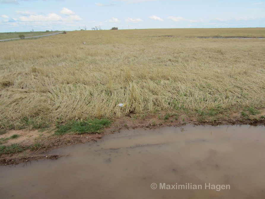
A once heavily forested area just east of SW 155th Street was obliterated by winds of EF5 intensity.

Even small shrubs were stripped completely of bark and leaves. Heavy debris was thrown several miles and found wrapped around the few remaining trees.

Pieces of destroyed vehicles, including a car seat and a steering wheel, where left strewn amidst destroyed trees.

The narrow core of peak winds spared a large, well-built brick home on SW 149th Street but passed directly over a forested area to the south. The few standing trees were stripped of all bark and branches. Vegetation in the immediate foreground and on the other side of the pond were outside the EF5 damage zone.

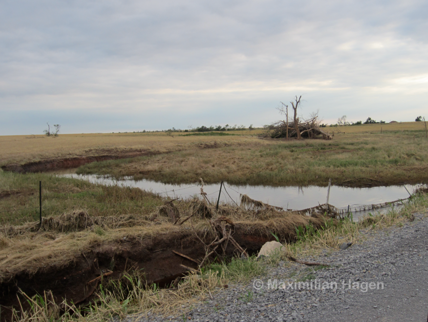
Grass scouring on an uphill slope near a cul-de-sac under construction. While heavy rainfall affected Oklahoma City in the weeks following the storm, all of the vegetation in this area was bent in the direction of the storm’s movement.
Homes on Nightshade Drive lay just outside the worst devastation. Some buildings were impaled by high velocity debris thrown from the funnel.
Extreme vegetation damage and ground scouring occurred at the southwest corner of 149th and Western Avenue.

A black truck was thrown from one of the residential neighborhoods far to the west and ripped into several pieces. Part of the frame along with the two rear tires is visible at center.

The EF5 damage streak was less than 40 yards in width. Powerlines visible in the background were installed after the storm.

A tree line was obliterated just west of Briarwood Elementary.

Debris from obliterated homes was ground into small pieces, a sign of extreme intensity.

The damage contour was sharp, particularly on the southern edge of the tornado’s path. The homes visible in this picture were immediately adjacent to the EF5 damage streak.

A neighborhood near Santa Fe Avenue was flattened and partially swept away. Two fatalities occurred in this area.

A huge, crumpled metal object was left in a backyard on Santa Fe Avenue. Surveyors later determined that it was a water tank that had been hurled 1.3 miles from Western Avenue (Ortega, Burgess et al., 2014).

High velocity debris was left imbedded in the ground in a drainage basin adjacent to Santa Fe Avenue. Upon closer inspection, most of the boards had penetrated between 6″ and 18″ into the ground. A damage survey concluded that several homes on SW 147th Street (two blocks beyond the grass field) were obliterated in EF5 fashion (Ortega, Burgess et al., 2014).

Metal fence posts anchored 18″ deep in concrete were a common site throughout the damage zones. Fence posts adjacent to homes with EF3 damage were bent nearly to the ground, whereas others were removed entirely in the worst affected areas.

A cargo container was thrown more than a quarter of a mile (according to a local resident) and left in the debris of a leveled home.

In the foreground, the remains of a brick home located a block southwest of Plaza Towers Elementary.

The remains of large, two-story homes of solid construction near Plaza Towers Elementary. I was unable to access the most intense damage on SW 14th Street due to numerous police checks and road blocks.

More than half of the tornado’s 24 fatalities occurred at Plaza Towers Elementary and adjacent homes. Seven children were killed in the collapse of the school and another six died in four homes swept completely away, primarily on SW 14th Street (the road with the empty foundations at left center). The school’s large field likely provided the tornado’s winds a brief respite from ground friction. Damage patterns indicated the most intense winds occurred during the backside of the storm. (Image by Geoff Legler)
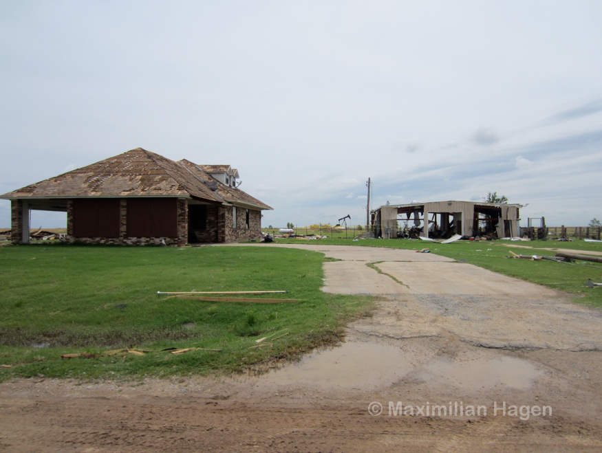
Heavy damage at Moore Medical Center. Small trees in the parking lot were stripped completely of bark and branches. A damage survey concluded that a row of homes just west of the complex experienced EF5 damage (Ortega, Burgess et al., 2014).
Due to extensive warning, no fatalities occurred in the medical center.
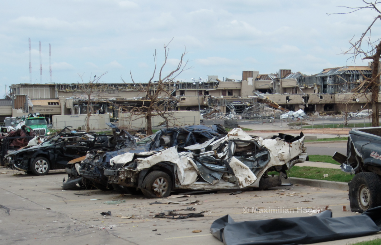
Extreme damage in the vicinity of the medical center.

Hundreds of vehicles were mangled beyond recognition in the tornado’s path.

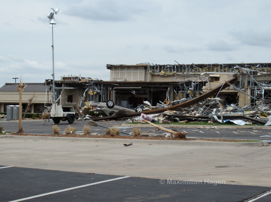
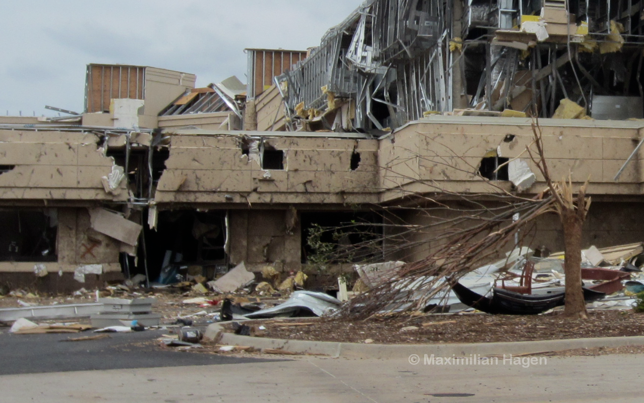
A large theater complex experienced minor damage as the tornado made a brief jog to the north. Buildings on three sides of the theater complex experienced EF3+ damage yet none of the small trees in the theater’s parking lot were uprooted.

Just west of the freeway, a large bowling alley was leveled to the ground. The steel cross-beams overlying the structure were broken and denuded. In the building’s parking lot, signs were bent to the ground in a southerly direction. Some of the signs were twisted due to the opposing forces in the front and backside of the storm. Large pieces of concrete were chipped from curbsides due to impacts from heavy debris.
The tornado abruptly narrowed after crossing the I-35 and turned to the east-southeast. The metal stand of a billboard was bent and broken just above ground level.

A trail of partial grass scouring and wind rowing only 15 yards wide was left in a field by Tower Drive. A powerline from Broadway Street (marked by an identification code) was lofted a quarter mile and wrapped in sheet metal.

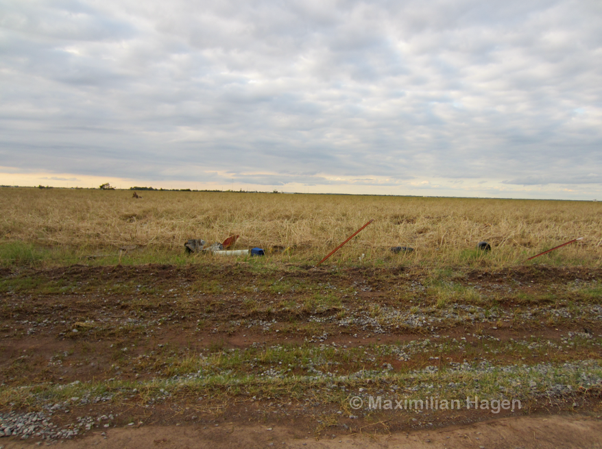
An office trailer was thrown from an unknown location and completely destroyed.
Frail sheds only a few yards away from the damage core were left standing.

The tornado’s damage contour became extremely sharp in eastern Moore. Homes on the south side of Madison Place Drive suffered superficial damage whereas homes on the other side of the street were leveled. A light pole was nearly pulled from its anchorage and thick brick pillars were ripped from the ground.
Personal Damage Survey Conclusions: Due to my belief that the Enhanced Fujita Scale grossly underestimates winds in violent tornadoes, the wind ranges I utilize are based on my research, discussions with wind engineers and comparisons between known surface readings and adjacent damage indicators in past tornadoes. My wind estimates are significantly higher than those employed by the National Weather Service.
Peak Intensity: EF5 (260mph+)
□ The Moore tornado likely reached EF5 intensity just east of Drexel Avenue and largely maintained this intensity up until it impacted Briarwood Elementary. The worst damage was confined within a 30-yard wide streak that was made visible by ground scouring and extreme vegetation damage. The largest trees impacted by the storm were stripped completely of bark and branches in a manner congruent with the most intense documented tornadoes. Vehicles were pulverized and large cargo containers and other objects weighing well over 10,000lbs were hurled more than a mile. Well-constructed two-story homes were swept completely away in areas just west of Moore. A secondary intensity maxima may have occurred from Plaza Towers Elementary to just west of the Moore Medical Center, where several entire streets of homes was reduced to concrete slabs. Pronounced wind rowing was visible in aerial photographs and grass was ripped from the ground. Metal fence posts with light concrete anchorage were bent to the ground or completely uprooted by a mixture of debris impacts and extreme winds.

The sharp contour between EF5 damage and EF1 damage is visible in this image from SW 149th Street.


